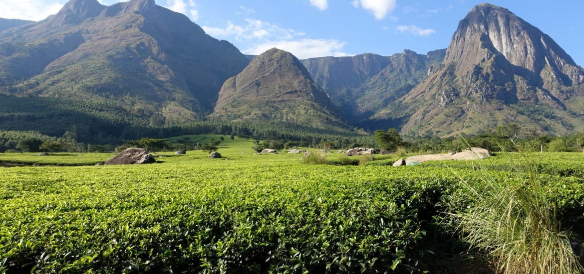
The Mulanje Massif, also known as Mount Mulanje, is a large monadnock in southern Malawi only 65 km east of Blantyre, rising sharply from the surrounding plains of Chiradzulu, and the tea-growing Mulanje district. It measures approximately 22 by 26 kilometres and has a maximum elevation of 3,002 m at its highest point, Sapitwa Peak.
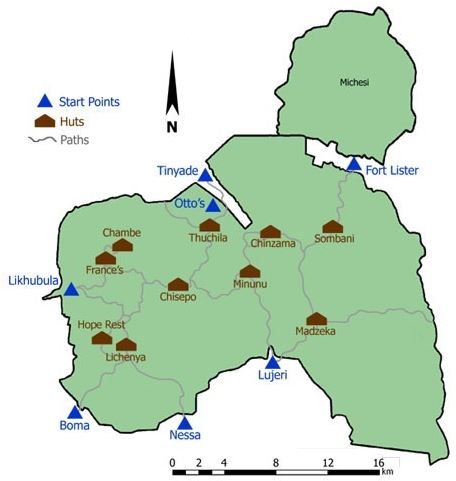
Much of the Massif consists of rolling grassland at elevations of 1,800–2,200 m, intersected by deep forested ravines. It has many individual peaks reaching heights of over 2,500 m, including Chambe Peak, the West Face of which is the longest rock climb in Africa.The Mulanje Massif, because its unique position as a “mountain island” rising more than 2,500 metres above the surrounding plains, is acting as a rain barrier. This becomes very visible when comparing the annual normal rainfalls, on and around the massif. The plateau level, at around 2,000 metres above sea level, annually experiences more than 2500 mm (100 inches) of rain, however, in the low plains around the foot of the Massif, the annual rainfalls, range around 40 inches. In the plains around the Mountain, it normally only rains in the rainy season, while it rains year round on the plateau level.The Massif is popular for hiking and climbing, and has several mountain huts scattered across it which are maintained by the Malawi Mountain Club (MMC) and the Malawi Forestry Department. There are ten huts on the mountain: Chambe, Chinzama, Chisepo, France’s Cottage, Lichenya, Madzeka, Minunu, Sombani and Thuchila. The tenth hut, Hope Rest Cottage (CCAP).